Find out how this phenomenally powerful and deadly thunderstorm forms.
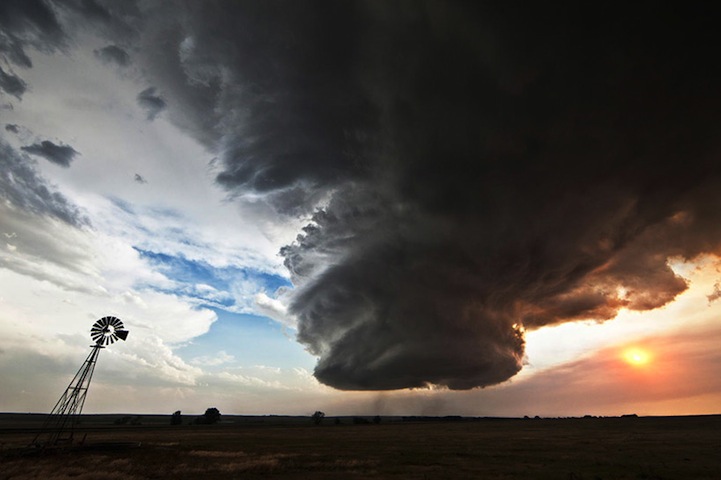
In this image we can see the culmination of a highly organised thunderstorm, commonly referred to as a ‘supercell’. Supercells are incredibly rare, with significantly fewer sightings than singlecell or multicell variants, but their unique properties make them incredibly dangerous when they do occur.
A supercell thunderstorm is similar to a singlecell storm and tornado in that it has a single main updraft. However, unlike the latter it is phenomenally strong, reaching estimated speeds of 240-280km/h (150-175mph). It is so strong that it can easily upturn cars, uproot trees and even destroy entire buildings.
The main difference between a supercell storm and other types is the presence of rotational energy. This causes the updraft to rotate (referred to as a ‘mesocyclone’) and helps to generate extreme weather in the supercell’s surrounding vicinity. This can include immense rain showers, massive two-inch-wide hail and violent tornadoes.
Interestingly, however – and the reason why this image is so amazing – precipitation tends not to fall back down through the supercell’s updraft when generated, instead being carried many miles downwind. Here, though, the supercell is depositing a huge torrent of rainfall directly through the updraft.